


Agrainâtes Lalonde

lucmarescot
User
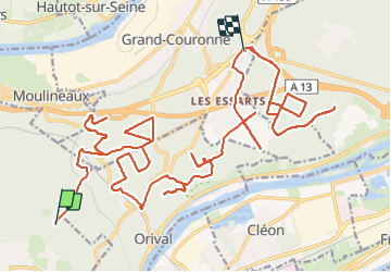

Length
35 km

Max alt
147 m

Uphill gradient
540 m
Km-Effort
43 km

Min alt
12 m

Downhill gradient
514 m
Boucle
No
Creation date :
2023-09-08 07:21:36.0
Updated on :
2023-09-08 10:20:12.304
2h58
Difficulty : Unknown

FREE GPS app for hiking
 SityTrail
IGN / Geographical institutes
SityTrail Plus
The world is yours!
About
Trail Other activity of 35 km to be discovered at Normandy, Seine-Maritime, La Londe. This trail is proposed by lucmarescot.
Description
1
Photos


Positioning
Country:
France
Region :
Normandy
Department/Province :
Seine-Maritime
Municipality :
La Londe
Location:
Unknown
Start:(Dec)
Start:(UTM)
352196 ; 5464505 (31U) N.
Comments